Description
The positioning of each cairn follows generations of accumulated wisdom about the sandbars. Path markers are placed to guide travelers along the firmest ground, following the subtle ridges and elevated areas where sand compacts most solidly. They steer walkers away from the treacherous seep lines where freshwater springs mix with saltwater, creating patches of liquefied sand that can trap the unwary. The spacing between cairns is carefully calculated so that each marker remains visible from the previous one even in fog or during the brief tropical twilights, typically about fifty paces apart along well-traveled routes and closer together in areas of particular danger.
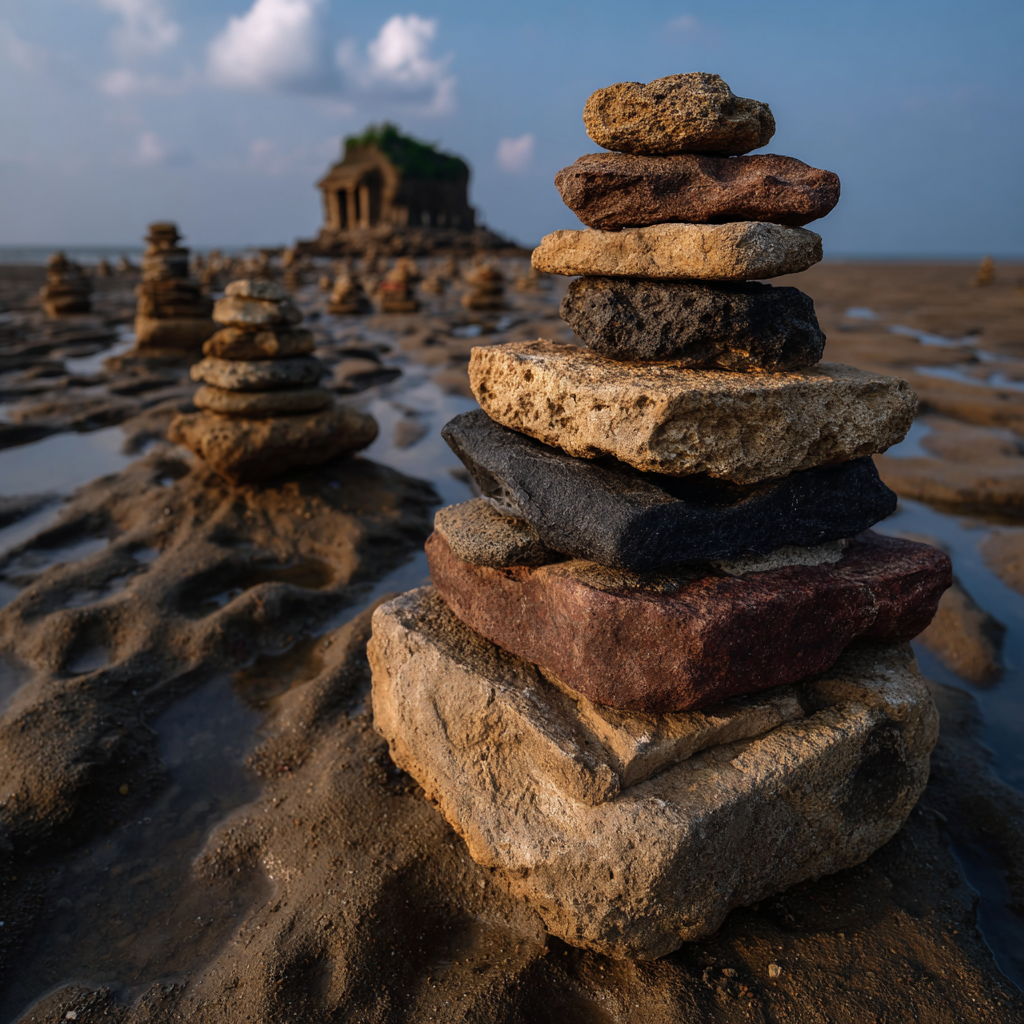
Each cairn is topped with a distinctive marker stone that indicates the route's purpose and difficulty. Smooth white coral stones mark the easiest paths suitable for children and inexperienced walkers. Rough black volcanic rocks indicate moderate routes that require attention and basic knowledge of the tides. Red-stained stones warn of difficult paths that should only be attempted by experienced guides and never during uncertain weather. Some cairns feature small carved wooden fish mounted atop the stones, painted in bright colors to indicate specific destinations: blue for fishing grounds, silver for the Pearl Fields, green for kelp harvesting areas, and gold for routes leading to the Storm Debris Zone.
The cairns require constant maintenance as storms knock them down, king tides shift their positions, and the migration of sandbars renders old paths obsolete while creating new safe routes. A dedicated team of path keepers walks the entire network twice weekly during low tide, rebuilding toppled cairns, relocating markers to account for sandbar movements, and removing cairns from routes that have become unsafe. These keepers carry baskets filled with appropriate stones for repairs, along with carved fish markers to update destination indicators. They use long probing poles to test ground firmness ahead of them, sometimes discovering that a path that was safe for years has become treacherous overnight.
The path keeper teams maintain detailed records of all route changes, updating large carved boards displayed at major settlement gathering points. These boards show simplified maps of the current safe routes, marked with the same color coding system as the cairn tops. Before heading out onto the exposed flats, experienced residents always check these boards, and teaching children to read the path marker system is considered a fundamental survival skill. During spring tide periods when Lumina's influence creates especially low water, new temporary routes are marked with specially marked cairns featuring white cloth strips, indicating paths that are only viable during these brief windows of opportunity.
Benefits
All Survival and Knowledge (geography) checks related to navigating the tidal flats during low tide gain a +4 bonus when following marked paths. Travel time across the sandbars is reduced by 30% compared to unguided navigation. The clear marking system prevents accidental entry into quicksand areas, reducing injuries and deaths from terrain hazards by 80%. The well-marked routes attract more visitors and traders willing to risk crossing the flats, increasing potential trade opportunities. This upgrade generates 3 Prestige.