Description
The Mapper's Stand occupies an elevated platform built around a mature beech tree whose naturally smooth bark and sturdy horizontal branches make it ideal for supporting the structure. The platform sits approximately fifteen feet above the forest floor, high enough to provide a commanding view of the surrounding terrain while remaining below the main canopy where wind might disturb delicate work. Access is gained via a gently spiraling wooden staircase that wraps around the trunk, its steps wide and secure enough to carry armfuls of surveying equipment or large rolls of bark paper. The platform itself extends outward from the tree in four directions like a cross, with each arm serving a different function. Railings of woven branches provide safety while remaining low enough not to obstruct sightlines for surveyors taking measurements. The beech tree continues to grow and thrive, its branches spreading above to provide natural shade during hot days while allowing ample light for the precise work conducted below.
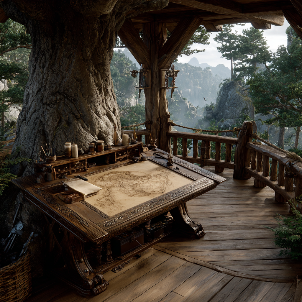
The eastern arm of the platform serves as the primary drafting area, featuring a large tilted work surface made from a single plank of aged oak, carefully planed smooth and sealed with natural resin to create an ideal surface for drawing. This drafting table can be adjusted to various angles using a simple but ingenious system of wooden pegs and supports, allowing cartographers to work comfortably whether creating small detail maps or large regional charts. Natural light floods this area during morning hours when most detailed work is performed, while oil lamps mounted on adjustable arms provide illumination for evening sessions. Storage cubbies built into the railing hold precisely measured rulers carved from straight-grained ash, compasses with brass points for drawing circles, triangulation instruments for calculating distances and angles, and dozens of specialized tools developed over years of mapmaking practice. Rolls of bark paper in various sizes hang from pegs, each one treated to remain flexible while resisting moisture, ready to receive the careful marks that will transform them into navigational aids.
The northern arm houses the ink and pigment station, where cartographers prepare the various colored substances used to denote different features on their maps. Natural materials provide all the colors needed: crushed charcoal mixed with tree sap creates deep blacks for outlines and text, berry juices produce reds and purples for marking important structures or dangerous areas, mineral clays yield yellows and ochres perfect for depicting clearings and meadows, and extracts from certain leaves create the greens used to show different types of forest growth. Each pigment is carefully prepared to specific consistencies, stored in sealed ceramic jars, and mixed fresh as needed to ensure consistent color across multiple maps. Fine brushes made from squirrel hair allow for detailed linework, while broader brushes of boar bristle enable quick filling of large areas. A small grinding stone allows cartographers to process raw materials into usable pigments, and a collection of reference samples shows exactly what color should be used for what purpose, ensuring that maps remain standardized and readable across different cartographers and time periods.
The southern and western arms serve as observation posts and reference areas. The southern platform offers an unobstructed view toward Autumn's Edge, allowing direct observation of the outer forest and providing orientation for surveyors heading into the field. The western platform looks deeper into the Ancient Heart, giving perspective on the dense old growth that forms the settlement's core. Both areas feature permanent surveying stations with fixed reference points, allowing cartographers to take consistent measurements over time and track subtle changes in the landscape. Shelves hold the completed map collection, each one carefully rolled and labeled with its scale, date of creation, and the region it depicts. The collection includes everything from highly detailed plots of individual settlement buildings to broad regional maps showing the entire Elderwood Grove and its surrounding areas, from topographical surveys showing elevation changes to specialized maps documenting water sources, game trails, medicinal plant locations, and seasonal phenomena. The accelerated growth rate within the dimensional bubble means that maps require more frequent updating than would normally be necessary, as plants reach maturity faster and seasonal changes cycle through more rapidly, but this also means the cartographers develop exceptional skill through constant practice and revision.
The work conducted at the Mapper's Stand serves countless practical purposes. Foresters planning sustainable timber harvests consult maps showing tree age and density. Builders planning new structures reference topographical maps to understand drainage and foundation requirements. Rangers patrolling the borders follow maps that mark known trails and identify areas where intruders might approach undetected. Herbalists use specialized maps showing where particular medicinal plants grow most abundantly, with seasonal notations indicating optimal harvest times. Visitors to the settlement receive simplified maps helping them navigate between key locations without getting lost in the vast forest. The cartographers who work here are meticulous individuals who combine artistic skill with scientific precision, spending days in the field taking measurements and observations, then returning to transform their notes into beautiful, accurate maps that are as much works of art as practical tools. They maintain detailed journals documenting their surveying expeditions, noting changes in the landscape, new discoveries, and anything unusual that might be worth recording for future reference. Over time, the collection of maps at the Mapper's Stand creates a historical record of the settlement's growth, showing not just where things are but how the community has evolved and expanded, transforming wild forest into carefully managed territory that still respects and preserves the natural character of the land.
Benefits
The Mapper's Stand provides detailed cartographic resources for navigation and planning. Any character who studies relevant maps here for at least 30 minutes before traveling gains a +2 circumstance bonus on Survival checks to avoid getting lost in mapped areas and a +2 bonus on Knowledge (geography) checks related to the Elderwood Grove. This upgrade generates 3 Prestige, reflecting the settlement's organized approach to land management and exploration.